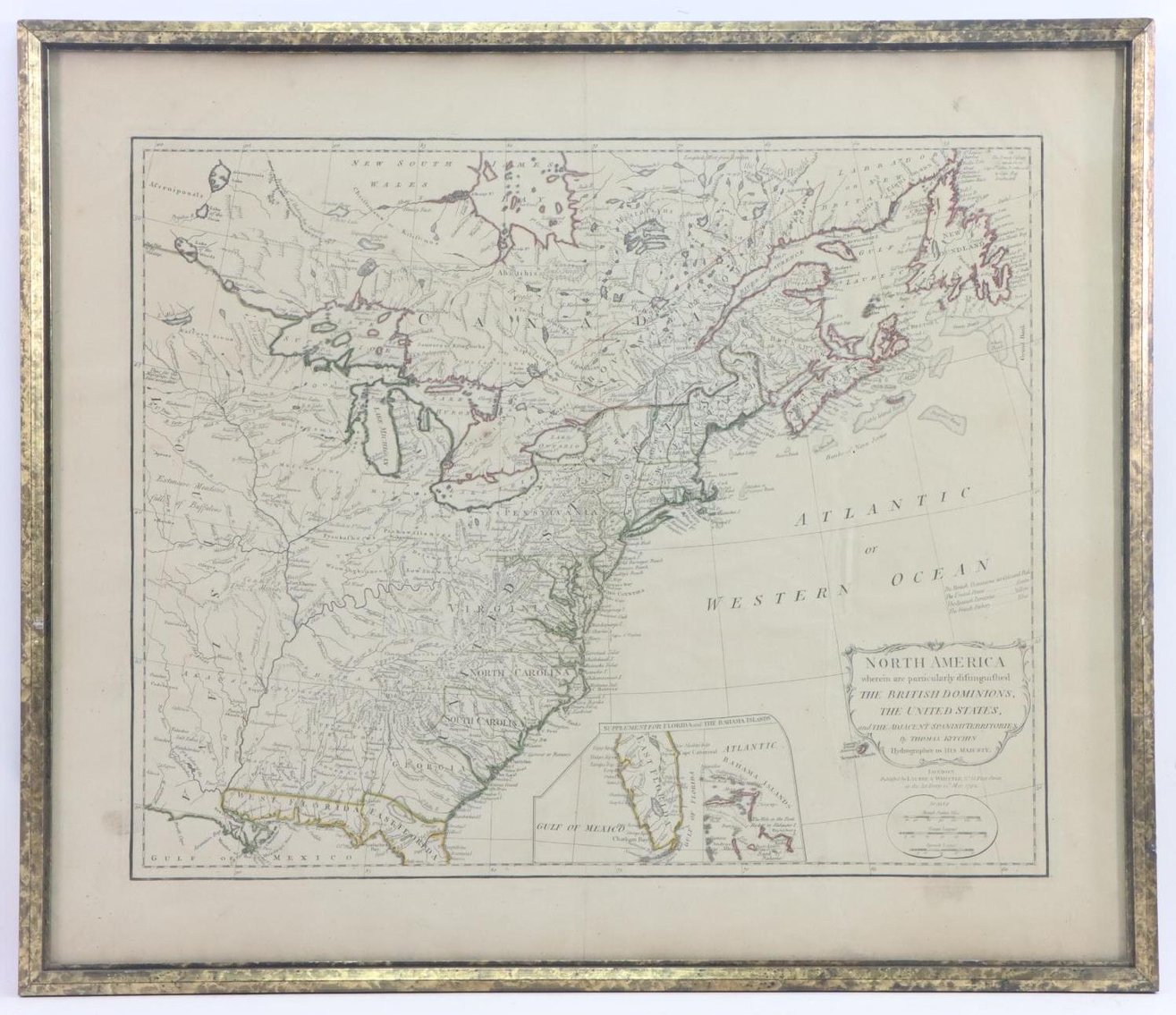
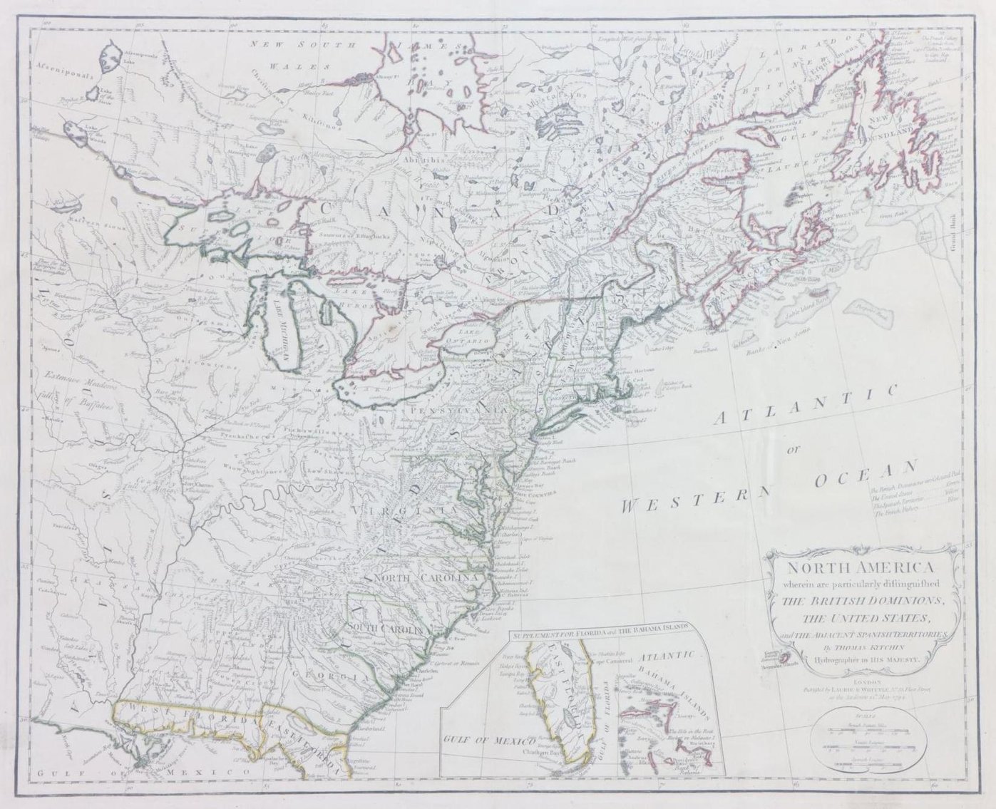
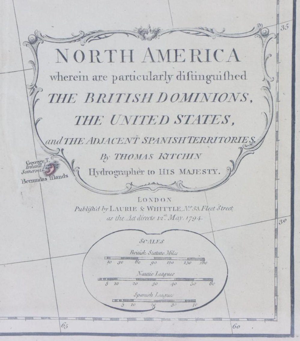
Map titled "NORTH AMERICA wherein are particularly distinguished the British Dominions, the United States, and the adjacent Spanish territories" by Thomas Kitchin and published by Laurie & Whittle, No. 53 Fleet Street (London) 12th May 1794.. Hand-colored map measures 21" x 24.75" (sight) and is housed in a frame measuring 22.5" x 26.25". Map exhibits some light foxing/toning and several small spots.
Quick Links
Contact Us
Hatfield Corporate:
501 Fairgrounds Rd.
Hatfield, PA 19440
Phone: 215-393-3000
Email: info@alderferauction.com
Fax: 215-368-9055
Hours for Pick-ups, Deliveries and Valuations by Appointment:
Monday – Thursday: 9:00AM – 4:00PM
Friday: 9:00AM - 3:00PM
____________________________________________
Doylestown Location:
3359 Durham Rd., Doylestown, PA 18902
Phone: 215-393-3000
Email: info@alderferauction.com
Hours for Valuations by Appointment:
Walk-In Wednesdays 10:00AM - 3:00PM
1st Thursdays of the Month - Meet the Specialist Valuations 10:00AM - 3:00PM
Appointments Preferred, Walk-Ins Welcome!
Appointments & Photos: preview@alderferauction.com or call 215-393-3000
#AY002260
Join Our Mailing List
Subscribe to our list and stay up to date with the latest news and deals!

2025 © Alderfer Auction. All Rights Reserved. Site powered by ![]()